iBerkshires.com Columnist SectionSue Bush
More articles from Sue Bush
Storm Generates Emergency Notices From Officials06:20PM / Sunday, April 15, 2007
 | | Snow and ice coat a vehicle parked at one of Southern Vermont's higher elevations. In the right background corner, wind has pulled several sections of siding from a home. |
National Weather Service, Albany, N.Y. - A wind advisory remains in effect until 6 a.m. April 16 for Southern Vermont, the Northern Taconics in New York and the Berkshire region of Massachusetts.
Wind Gusts Up To 55 Miles Per Hour
Sustained wind speeds from 20 to 35 miles per hour with wind gusts up to 55 miles per hour are likely. The strongest winds are expected to travel acorss the highest elelvations, with wind direction shifting from the east during Sinday evening to the north or northeast during Monday morning. Eastern and northeastern facing mountain slopes will be especially vulnerable to high winds.
The high winds are expected to come during a deepening and intensifying low pressure system near the Delmarva Peninsula which is moving to an area near New York City. The system should be in the New York City vicinity during Monday morning and is expected to stall over the Southern New England region before moving out to sea on Tuesday.
Waterbury, Vt. — Vermont officials have worked throughout the weekend in advance of a spring storm that is expected to hit the area on Sunday night and Monday.
Winter Storm Warning State-Wide
The National Weather Service has issued a Winter Storm Warning for the state of Vermont. NWS is predicting accumulations of heavy, wet snow; high winds; and significant amounts of rain to all areas of the state.

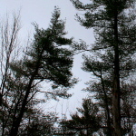
Trees bend in the wind during April 15 storm. |
These conditions have the potential to cause power outages, and could lead to flooding in areas with the greatest amount of precipitation.
Vermont Emergency Management, the Vermont State Police, and the office of Governor Jim Douglas have prepared a coordinated response, should it be needed. This response includes state agencies like Transportation and Public Service. The Vermont Emergency Operations Center will be on an elevated alert level for the duration of the storm.
State officials have also been in contact with power companies to help assist in their response, if needed. Power crews are prepared for any outages that may occur with multiple line and tree crews.
The American Red Cross has also been put on alert should power outages or floods occur. The Red Cross will be able to mobilize quickly should residents be forced from their homes and have a need for shelter.
Preparedness Urged
Residents are urged to prepare for this storm and take certain safety precautions throughout:
* The elderly and those with special needs should call their power companies and advise them of those needs.
* Those who know or live near special needs residents or the elderly are also asked to check on their neighbors regularly throughout the storm, and help with snow removal if possible.
*Heavy, wet snow can lead to roof collapse, so homeowners should be aware of snow loads on roofs and remove the snow. It is most important to assess personal risk of removing snow from a roof and call a professional if necessary.
A dirt road, deeply rutted from April's temperature variations, was smothered with ice and snow during an April 15 Nor'easter. |
* As always, be cautious when clearing snow, do not over-exert, stay hydrated, and take frequent breaks. Snow shoveling can lead to heart attacks or sudden death in at-risk and other populations, so care is urged when clearing snow.
* Drive safely throughout the storm, and first assess if your trip is necessary. Allow for extra time for your trip so you can drive appropriately for road conditions. Maintain a safe distance from other cars in travel lanes. Never drive across a flooded road; floods can cause unseen washouts, or currents can be strong enough to sweep a car off the road.
|
|
Advertise on
iBerkshires.com
|


